
We scan your building with a Matterport Pro3 camera and hand you a photoreal, walkable 3D tour — plus measured floor plans — that anyone can open from a browser, anywhere in the world. No app, no site visit, no waiting on a broker's schedule.
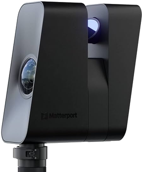
A fully explorable digital twin of the property, viewable from any browser — no software, no app download, no scheduling a walk-through.
Auto-generated schematic floor plans and a dollhouse view, measured directly from the scan — accurate enough to plan around.
Drop it into a listing, an email, or a text. Embed it on your own site. Every stakeholder sees the exact same space.
Revisit the space six months from now without booking another site visit. The scan stays live for as long as you need it.
A live Matterport tour from a South Florida project — full technical documentation package for a design/engineering firm's client project — laser scan, bim, mep, floor plans, elevations, and measurements delivered as one engagement.
From the first call to final delivery, the same person leads every step — no handoffs, no surprises.
You'll spend 20–30 minutes on a call directly with leadership, not a salesperson. We'll talk through your building, your timeline, and what you actually need at the end. If it's not a fit, you'll hear that on the call.
We plan the visit around how your building runs — after hours for retail, around tenants for occupied buildings. You'll know exactly who's on site and when.
Once we leave site, your data is processed and checked before anything goes out. You're not the quality control.
You get your files in whatever format you actually work in — Matterport link, CAD, Revit, or straight video/photo files — plus a quick handoff call so nothing gets lost.
Listing tours, condition documentation, and portfolio photography for brokers, landlords, and property managers.
Full as-built packages — laser scan, scan-to-CAD, scan-to-BIM, MEP documentation — for firms that need accurate existing-conditions data on a client project.
Pre-construction baseline documentation and progress monitoring via drone and 360 capture.
Recurring documentation for buildings that need to stay current as spaces change.
Fast, accurate 3D documentation for pre-loss baselines and post-loss claims. Our scans and as-built captures give adjusters and property owners a verified record of condition — reducing disputes and speeding settlements.
Matterport tours and photography built for leasing at scale. We help property management teams fill vacant units faster with immersive walkthroughs.
“Their attention to detail on aerial mapping work is unmatched — exactly the standard a construction timeline needs.”JOHN D. — CONSTRUCTION MANAGER
“An exceptional partner we trust to extend service to our own clients across South & Central Florida.”FRANK M. — ENVISIA360